Survey Services
We deliver high-precision technical surveys for land and offshore projects
Survey Services
Lorem ipsum dolor sit amet, consectetur adipiscing elit. Ut elit tellus, luctus nec ullamcorper mattis, pulvinar dapibus leo.
Bathymetric Surveys
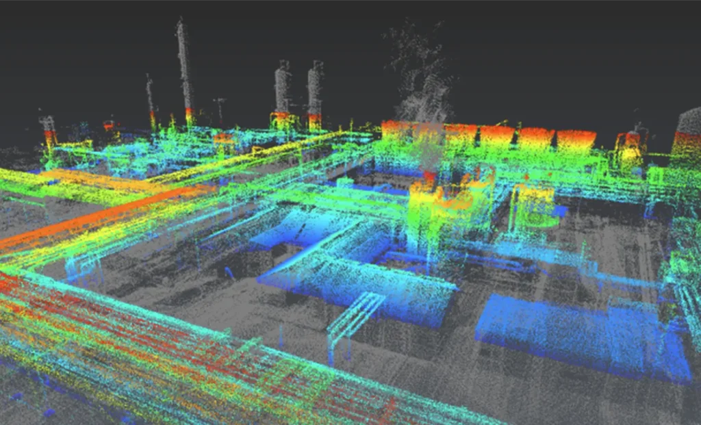
High precision bathymetric surveys delivering reliable seabed depth and terrain data. Our service supports safe navigation, efficient dredging, and accurate planning for ports, pipelines, and subsea infrastructure.
Survei batimetri presisi tinggi untuk menghasilkan data kedalaman dan kontur dasar laut yang akurat. Layanan ini mendukung keselamatan navigasi, efisiensi pengerukan, serta perencanaan pelabuhan, pipa, dan infrastruktur bawah laut.
Geophysical Surveys
Advanced geophysical surveys designed to reveal subsurface conditions beneath the seabed. We help reduce project risks by detecting buried objects, seabed features, and potential geohazards before construction begins.
Survei geofisika lanjutan untuk mengidentifikasi kondisi bawah permukaan dasar laut. Layanan ini membantu meminimalkan risiko proyek dengan mendeteksi objek tertimbun, karakteristik dasar laut, dan potensi bahaya sebelum konstruksi dimulai.
Construction Support
End to end survey and positioning support throughout your marine construction activities. We ensure accuracy, efficiency, and compliance at every stage of offshore and nearshore project execution.
Dukungan survei dan positioning menyeluruh untuk kegiatan konstruksi laut. Kami memastikan akurasi, efisiensi, dan kesesuaian standar pada setiap tahap pelaksanaan proyek offshore maupun nearshore.
Barge and Tug Management Positioning
Precise positioning and control of barges and tugboats to ensure safe and efficient marine operations. Our service enhances operational accuracy during offshore construction, transport, and installation works.
Layanan positioning dan pengelolaan barge serta tugboat secara presisi untuk menjamin operasi laut yang aman dan efisien. Mendukung pekerjaan konstruksi, transportasi, dan instalasi offshore.
Meteorology and Oceanography Service
Reliable weather and ocean condition data to support confident offshore operations. Our meteorological and oceanographic services help optimize planning, minimize downtime, and improve operational safety.
Penyediaan data cuaca dan kondisi laut yang andal untuk mendukung operasi offshore yang lebih aman dan terencana. Membantu optimalisasi jadwal kerja, pengurangan downtime, dan peningkatan keselamatan.
Geotechnical Services
Comprehensive geotechnical investigations delivering critical seabed soil data. We support safe foundation design, structural integrity, and long-term performance of offshore and marine structures.
Layanan investigasi geoteknik yang menyediakan data penting mengenai sifat tanah dasar laut. Mendukung perencanaan fondasi yang aman, stabilitas struktur, dan ketahanan jangka panjang.
Digital Twin Laser Scan (Land)
High-resolution laser scanning delivering accurate digital twin models of onshore assets. This service enhances planning, asset management, inspection, and future development with data you can trust.
Pemindaian laser resolusi tinggi untuk menghasilkan model digital twin aset darat secara akurat. Mendukung perencanaan, inspeksi, pengelolaan aset, dan pengembangan di masa depan.
Underwater Laser Scan
State-of-the-art underwater laser scanning for highly detailed 3D subsea models. Ideal for precise inspection, condition assessment, and documentation of underwater assets with minimal operational disruption.
Teknologi pemindaian laser bawah air terkini untuk menghasilkan model 3D struktur subsea yang sangat detail. Ideal untuk inspeksi presisi, penilaian kondisi, dan dokumentasi aset bawah laut.